Restricted Area Trekking in Nepal
Upper Mustang Trek
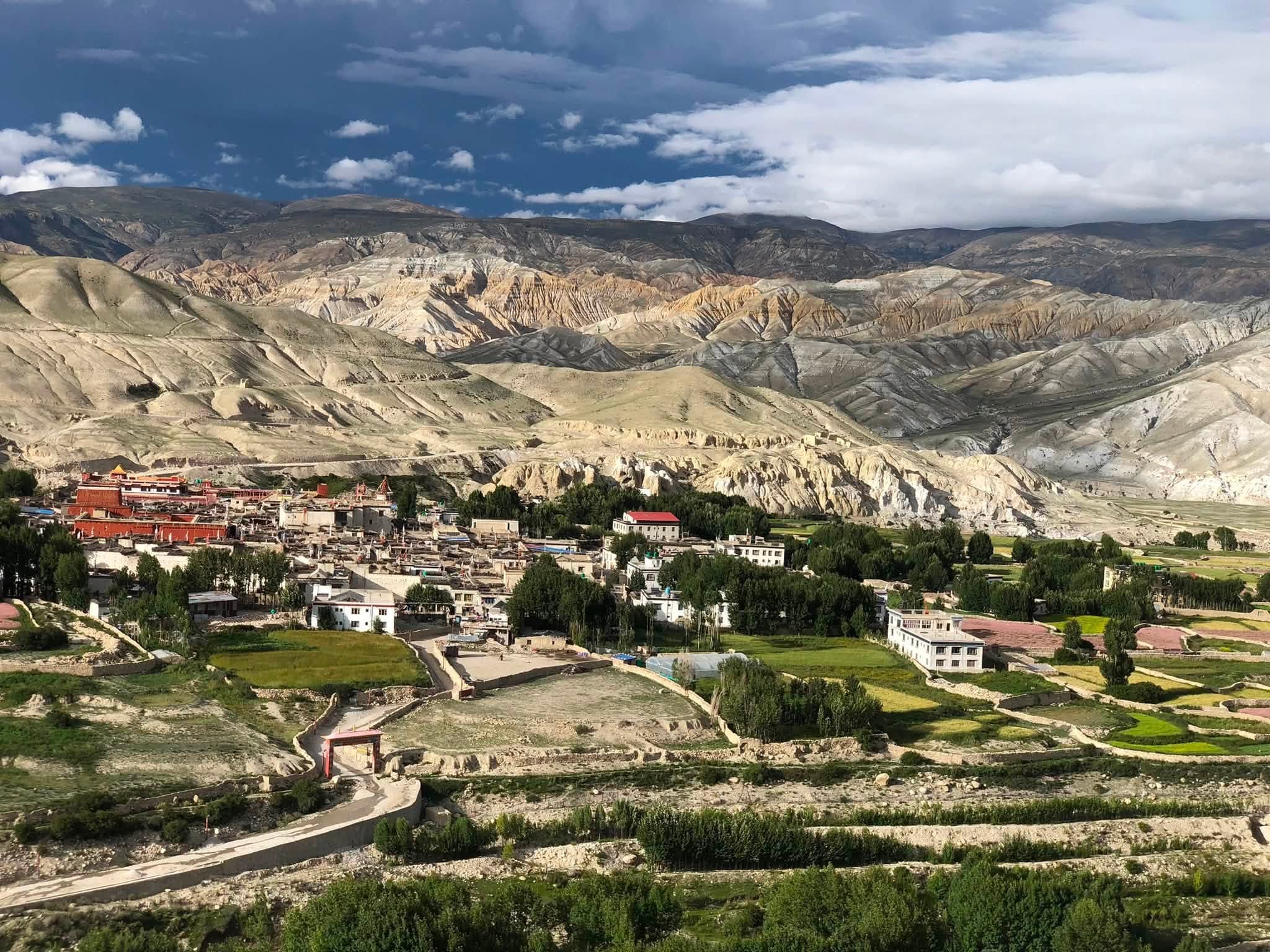
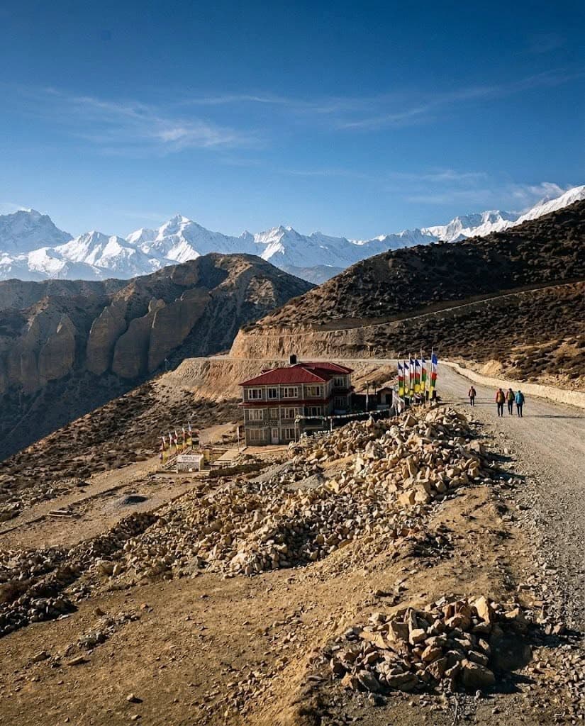
The first thing is that the Upper Mustang Trek offers a very unique journey through the former Kingdom of Lo, which preserves authentic Himalayan culture. It meanders through dry canyons, wind-eroded cliffs, ancient monasteries, and traditional villages such as Kagbeni at 2,804 meters and Ghami at 3,520 meters. The region lies in the Himalayan rain shadow, thereby resulting in excellent conditions for trekking almost throughout the year. The trek initiates from Jomsom (2,720 m) and gains height gradually to enter the restricted territory.
On the second day, it pursues a gradual climb up to Charang (3,560 m); medieval caves and century-old cultural remnants are investigated by trekkers. The topography now brings deep gorges and bright red cliffs, dissected by strong winds blowing around Mustang. Trekkers notice Buddhist prayer walls, whitewashed chortens, and traditional settlements reflecting Tibetan heritage. The environment remains peaceful because the government controls visitor numbers.
Lo Manthang, at 3,840 meters above sea level, is considered the cultural center of Upper Mustang and lures travelers with its walled city and ancient palace. The narrow lanes house monasteries such as Jampa, Thubchen, and Chode that protect rare frescoes and sculptures of Buddhism. The restricted nature of the region shields its cultural identity and keeps its sacred aura alive. Trekkers experience a unique lifestyle shaped by isolation and resilience.
Moreover, because Upper Mustang shares borders with Tibet, special permits are required due to the historical sensitivity of the area. The Restricted Area Permit costs 500 USD for 10 days, and 50 USD per day thereafter. Additionally, trekkers have to possess the Annapurna Conservation Area Permit in order to complete the journey. There is strict control over permits, which has promoted sustainable tourism and helped protect local communities.
The journey also traverses through dramatic landscapes of the Kali Gandaki Gorge, high desert plateaus, and barren cliffs carved out by ancient seas. Trekkers get to see magnificent views of Nilgiri (7,061 m), Dhaulagiri (8,167 m), and Annapurna (8,091 m) while approaching. The topography keeps on changing with colored rocks and open space. These scenes make them feel so isolated yet peaceful.
Similarly, the track also has culturally enriching experiences, such as traditional festivals like Tiji in Lo Manthang. The trekkers usually arrive in far-flung villages like Yara (3,650 m) and Dhi (3,410 m) that harbor ancient cave complexes. These caves contain historical paintings and artifacts linked to ancient Himalayan civilizations. The trek becomes a cultural exploration rather than a simple mountain journey.
The difficulty for the route is moderate, as the terrain remains dry and the rise in altitude is very gradual. Trekkers walk past windy sections and gentle ascents that suit experienced hikers and determined beginners. The elevation rarely exceeds 4,300 m, which reduces altitude-related risks. These stable weather conditions contribute to consistent trekking performance.
Last but not least, the Upper Mustang Trek is a very rare adventure that connects culture, history, geology, and mountain scenery. This is protected by a restricted system that ensures authenticity in travel experiences. Trekkers return with profound respect for Mustang's spiritual heritage and distinctive landscapes. The journey feels timeless, steeped in culture.
Manaslu Circuit Trek
First, the Manaslu Circuit Trek offers a dramatic journey around Mount Manaslu, at 8,163 m, the eighth highest mountain. The trail commences at Machhakhola, at an altitude of 930 m, and it traces the Budhi Gandaki River through deep valleys and steep hillsides. Because of its restricted area status, natural landscapes and local cultures, especially those in the Nubri and Tsum regions, are better preserved. This journey mixes mountain beauty and real Himalayan life.
Then, the trek continues through Jagat (1,410 m), Deng (1,860 m), and Namrung (2,630 m), showing Buddhist heritage to the trekkers. Villages are filled with stone houses, prayer wheels, and colorful mani walls, reflecting Tibetan influence. Gradual ascent allows acclimatization before trekkers reach higher settlements. Few trekkers have restricted permits, which makes this region serene.
Further, the middle part consists of Lho (3,180 m) and Samagaun (3,530 m), lying directly beneath the gigantic north face of Manaslu. Trekkers usually make excursions to Pungyen Gompa (4,050 m) and Manaslu Base Camp (4,800 m) for acclimatization. These extensions offer sweeping views of Manaslu, Himalchuli (7,893 m), and Naike Peak (6,210 m). The region’s cultural depth enriches each side's excursion.
Further up the trail is Samdo at 3,875 meters, near the Tibetan border, carrying with it centuries of salt-trading history. Trekkers see a high-altitude environment sculpted by cold winds and open landscapes. Authentic Tibetan customs are well-preserved in this village through the implementation of the restricted-area policy. The final acclimatization here prepares trekkers for Larke Pass.
Larke Pass at 5,160 m forms the highest and most iconic section of the trek and demands one's steady effort. Trekkers cross glacial moraines, icy patches, and rocky trails until finally reaching the prayer-flag-covered summit. The views include Cheo Himal at 6,820 m, Himlung at 7,126 m, and Kang Guru at 6,981 m. The route of descent heads toward Bimthang at 3,720 m, which provides a scenic rest stop.
Similarly, the lower descent from Bimthang to Dharapani (1,860 m) passes through lush forests and clear streams. People feel the dramatic transition from alpine terrain to mid-hill landscapes. The trail remains comfortable because of the quick drops in altitude and thickening of vegetation. The journey ends peacefully with warm hospitality.
In return, the Manaslu Circuit Trek needs Restricted Area Permits to control tourism. It costs USD 100 in peak season and USD 75 in other months, thus aiding in the protection of the environment. To be able to trek around the circuit, trekkers also need the MCAP and ACAP permits. This attracts fees, which are important for conservation projects across the Manaslu region.
Finally, the Manaslu Circuit Trek offers an unforgettable combination of scenery, culture, and remote adventure. The restricted system ensures fewer crowds and stronger preservation practices. In return, trekkers see dramatic landscapes and have meaningful cultural encounters. In fact, it is one of Nepal's most balanced and rewarding adventures.
Tsum Valley Trek
First, the Tsum Valley Trek offers a culturally enriching journey into one of Nepal's most isolated valleys in the Himalayas. The trail starts from Machhakhola at 930 meters, following the Budhi Gandaki River up to the restricted area of Tsum. Trekkers come across precipice-like cliffs, narrow mountain trails, and villages that take shape according to the traditions of Tibetan Buddhism. The restricted status maintains its spiritual identity.
Further, the landscape changes while trekkers reach Philim's height of 1,570 m, which is the entrance to Tsum Valley. The trekking routes are lined up with terraced fields, pine forests, and stone houses, which turn all sceneries into peaceful ones. This valley narrows into dramatic gorges carved by ancient glacial activity. It still feels untouched because the region allows a minimal number of visitors. The trail further ascends to Chumling at 2,386 meters and Chhokangparo at 3,010 meters, which still retain ancient monasteries and traditional culture. Trekkers enjoy wide views of the Ganesh Himal at 7,422 meters and Shringi Himal at 7,165 meters. The villages provide insight into traditional farming and Himalayan architecture. The cultural depth grows stronger as trekkers move higher. Additionally, the upper valley consists of Nile at 3,361 m and Mu Gompa at 3,700 m, which are just a few steps from the Tibetan frontier. Centuries-old meditation caves and small hermitages are maintained by monks and relate deeply to the Buddhist traditions. Trekkers commonly visit Dhephu Doma Gompa at 3,910 m for its quiet mountain views. This region is spiritually important. Moreover, the trail offers scopes to learn about the peculiar history of Tsum attached with ancient Himalayan trade routes. The local communities practice non-violence, which is known as "Tsampa"; they respect animals immensely. Due to staunch cultural protection policies, traditional festivals and rituals are preserved in the region. Trekking herein is just like entering a living museum. Likewise, the altitude rises gradually, making the trail moderate, with the terrain remaining stable. Trekkers walk through forested paths, suspension bridges, and terraced landscapes before getting to alpine terrain. The controlled visitor numbers help maintain trail quality and local peace. Such calm environments add rewards for trekkers on their journeys. As a result, Tsum Valley is a Restricted Area that requires a permit: USD 40 per week in high season, to regulate tourism flow, and support cultural and environmental conservation. Trekkers also need the MCAP and ACAP permits for the approach route. These combined permits protect remote Himalayan communities. Finally, the Tsum Valley Trek offers an intensely spiritual, picturesque, and culturally engaging experience. The controlled mechanism promotes responsible travel practices and fosters ecotourism. Trekkers enjoy the pristine views of nature, holy monasteries, and warm hospitality of locals. The trek stands as a perfect choice for those seeking peaceful Himalayan exploration.
Upper Dolpo Trek
Above all, the Upper Dolpo Trek leads trekkers into one of Nepal's most isolated Himalayan regions, with deep cultural and spiritual landscapes. The journey starts at Juphal, 2,475 meters, and moves on through terracing fields and traditional villages until it reaches the protected zones. After Suligad Gorge, it follows a gentle ascend towards Phoksundo Lake at 3,611 meters. The region still has strict restricted policies to protect these delicate mountain communities.
It continues onward to Ringmo, at 3,600 meters, a village where trekkers find ancient Bon traditions and centuries-old monasteries. The turquoise-colored water of Phoksundo Lake contrasts beautifully with the surrounding barren cliffs, worn by Himalayan erosion. The village is surrounded by traditional wooden houses and a land use pattern with seasonal grazing. It is a relatively virgin environment since few trekkers receive restricted permits.
The route climbs above Phoksundo on narrow cliff paths to higher valleys dominated by alpine winds and open plateaus. Trekkers cross tiny bridges, stone steps, and rugged moraines en route to the Upper Dolpo settlements. This area shows barren hills, wide canyons, and dramatic high-altitude shadows. These reflect geological influence from the Tibetan Plateau.
Furthermore, Shey Gompa at 4,350 m is a spiritual heart of Upper Dolpo and attracts many pilgrims during the Shey Festival. This monastery lies below Crystal Mountain (5,416 m), considered sacred by local tribes. Trekkers often circle the mountain as part of a traditional kora. The religious depth creates a profound sense of connection.
The route also includes many high passes, like Kang La Pass at 5,360 m and Saldang La Pass at 5,200 m, which require steady stamina. The passes open wide panoramas of Kanjirowa Himal at 6,883 m and nearby desert ridges. Unmatched silence and clear views come with this restricted landscape. Trekkers experience extreme wilderness without crowds.
Similarly, the villages like Saldang 3,902m, Dho Tarap 4,040m, and Tokyu 4,200m preserve ancient lifestyles related to farming barley and herding yaks. The stone houses lie along dry slopes, carved out by winter winds. Trekkers observe prayer flags, chortens, and Mani walls that reflect Bon and Buddhist heritage. Because access has been limited, cultural preservation remains strong.
For this reason, trekking in Upper Dolpo requires two permits: the Restricted Area Permit and the Shey Phoksundo National Park Permit. This restricted permit costs USD 500 for 10 days and an additional USD 50 per day. In that way, tourism is controlled to preserve the fragile ecosystems of the Himalayas. This system ensures sustainability on a long-term basis.
Lastly, the Upper Dolpo Trek is a rare combination of wilderness, spirituality, and cultural authenticity. The restricted nature of this region protects its unique traditions and landscapes. Trekkers often develop great regard for Dolpo's resilience and sacred heritage. This journey remains one of Nepal's most challenging yet rewarding expeditions.
Lower Dolpo Trek
First of all, Lower Dolpo Trek guides trekkers into one of Nepal's most beautiful restricted areas, featuring bare hills and serene Himalayan lakes. The journey starts from Juphal (2,475 m), where the trail moves through millet fields, pine forests, and narrow gorges. Trekkers soon reach Dunai (2,140 m), the district headquarters. The restricted system limits tourism and maintains the ecological balance.
The route then picks the Suligad River and follows it up to Chhepka at 2,670 meters, which forms the entrance to Shey Phoksundo National Park. Trekkers notice how the vegetation changes from rich forests to bare cliffs. The trail includes stone steps, bridges made of wood, and waterfalls carved by seasonal flows. With every meter gained, the environment becomes more dramatic.
Moreover, the route to Phoksundo Lake (3,611 m) presents unforgettable Himalayan scenery with turquoise water and steep rock walls. It still remains one of Nepal's deepest high-altitude lakes and displays unique geological formations. Ringmo village (3,600 m) lies beside the lake and preserves the ancient culture of Bon. The spiritual richness adds depth to the journey.
The trail climbs up to Dho Tarap, at 4,040 meters, one of the highest permanent settlements in the world. Trekkers reach passes like Baga La at 5,190 meters and Numa La at 5,360 meters, which bring into view wide panoramas of the Kanjirowa Himal (6,883 m). The area feels remote and peaceful because few trekkers make it into these high valleys. The thin air demands careful pacing.
Besides, the villages of Tarap Valley show stone-walled houses and barley fields shaped by high-altitude living. Trekkers also observe traditional clothing, local weaving, and rituals based on Bon and Buddhist beliefs. Such a restricted policy helps preserve these ancient customs. The locals are still very hospitable despite the terrain.
Likewise, the return journey descends via Yak Kharka, Sisaul, and Laina Odar, where the vegetation gradually thickens. The trail features narrow paths, cliff edges, and long river sections that test endurance. Trekkers are rewarded with an exemplary transition from high alpine landscapes to mid-hill greenery. The journey remains balanced and diverse in nature.
Therefore, Lower Dolpo is a Restricted Area, and it requires a permit with a cost of USD 20 per week per person. It is cheaper compared to Upper Dolpo, making the trek easier and more accessible. Trekkers also require the Shey Phoksundo National Park Permit. The controlled system protects wildlife such as blue sheep and Himalayan musk deer.
Finally, Lower Dolpo Trek is an ideal option for those trekkers who want to see both landscapes, culture, and wilderness, but without extreme remoteness. Here, the restricted environment promises peaceful trails and preserved traditions. The trek offers rich culture, dramatic terrain, and authentic high-altitude experiences. This is one of the best adventures in western Nepal.
Nar Phu Valley Trek
Nar Phu Valley Trek takes trekkers to a hidden and impressive Himalayan landscape with dramatic cliffs, stone villages, and preserved Tibetan traditions. The hike starts from Koto at 2,600 m, which is located near the entrance of the restricted valley. From here, a trail goes along the Naar Khola River through narrow gorges and steep rock walls. The restricted policy maintains quiet landscapes and sustainable tourism.
Next, the track goes up steadily to Meta at 3,560 meters, where open plateaus reveal the valley's rough topography. Trekkers observe changes in vegetation that shift from pine forests to barren slopes. Sceneries include waterfalls, suspension bridges, and wide mountain shadows. The environs stay tranquil due to controlled numbers of visitors. Furthermore, the trail leads to Phu Village at an altitude of 4,080 meters, a culturally preserved village of Nepal. Trekkers visit Tashi Lhakhang Gompa at 4,080 meters, an ancient monastery blessed by the Dalai Lama. The breathtaking views include Himlung Himal at 7,126 meters, Kang Guru at 6,981 meters, and Pisang Peak at 6,091 meters. Cultural depth enriches every moment. Moreover, at 4,110 meters above sea level, Nar Village boasts a high-altitude plateau and offers a peek at centuries-old Himalayan livelihoods. Trekkers see fields of barley, pastures of yaks, and narrow alleys paved with flagstones. The local communities practice Tibetan customs, which in themselves have been moulded by the isolation and altitude. The village is peaceful and spiritually captivating. Additionally, Kang La Pass (5,322 m) forms the highest section of the trek and requires stable pacing and strong endurance. The pass opens onto grand views toward Annapurna II (7,937 m), Tilicho Peak (7,134 m), and surrounding ridges. Trekkers drop down toward Ngawal (3,660 m), where the terrain becomes easier. High alpine offset the contrast of lower valleys to a rewarding transition. Similarly, the Nar Phu Trek links with the Annapurna Circuit, which makes for a wealth of route variation. Trekkers love the forested trails, stone bridges, and wide trails hewed from centuries of transiting. The altitude becomes almost pleasant as the trail unfolds toward Manang at 3,540 meters. The area boasts better amenities yet retains none of the pretension. Due to this fact, the Nar Phu Valley needs a Restricted Area Permit, which costs USD 100 per week in high seasons. Additionally, trekkers must have an Annapurna Conservation Area Permit. This helps in the protection of fragile ecosystems and traditional cultures, and controlled tourism ensures long-term sustainability. Finally, the Nar Phu Valley Trek stands as a culturally rich and scenically diverse Himalayan journey. The restricted nature keeps the region peaceful and authentic. Trekkers experience dramatic landscapes, sacred monasteries, and meaningful cultural encounters. It remains a perfect choice for adventurous travelers seeking deep cultural immersion.
Kanchenjunga North Base Camp Trek
First, the Kanchenjunga North Base Camp Trek leads trekkers into the most remote restricted region of Nepal, a land of dramatic Himalayan landscapes. The route starts from Taplejung, at an altitude of 1,820 meters, with gentle terraced hills and dense forests. The path follows the Tamor River toward Sekathum at 1,650 meters. Restricted access preserves natural and cultural purity.
From here, the trail heads to Amjilosa that has an elevation of 2,498 m; steep cliffs and waterfalls adorn this part of the route. Trekkers walk past rhododendron forests with narrow paths carved above deep gorges. The changing altitude reveals diverse Himalayan vegetation. The peaceful environment reflects strict trek regulations.
Furthermore, Ghunsa at 3,430 m comes as the first big Sherpa village with typical wooden houses and ancient monasteries. Trekkers learn about high-altitude agriculture and yak herding traditions shaped by severe winters. The village provides an important acclimatization stop. The spiritual atmosphere will prepare trekkers for higher terrain.
Further, the trek trail reaches Khangpachen at 4,050 meters, from where dramatic views of Jannu, 7,710 meters, dominate the skyline. The landscape now becomes rocky, with glacial moraines and wide open valleys. Trekkers experience colder winds and stronger sunlight at higher elevations. With every step, the feeling of remoteness increases.
In addition, the final ascent to Pangpema, at 5,143 meters, better known as Kanchenjunga North Base Camp, offers clear views of Kanchenjunga Main at 8,586 meters. The massive towers above long glaciers and barren ridges shaped by deep Himalayan pressure. Trekkers enjoy panoramic views that extend across the Nepal–India border. The experience highlights true Himalayan wilderness.
Similarly, the return journey retraces the route through spectacular valleys and alpine ridges. The trekkers gradually descend to Ghunsa and Phale (3,140 m) as the forest thickens. The trail allows one to adapt slowly to the lower air. The transition enhances comfort and stamina.
Hence, the restricted trek needs the Kanchenjunga Restricted Area Permit, which costs USD 20 per person per week during peak seasons. Additionally, trekkers require the Kanchenjunga Conservation Area Permit. Such regulations are important for protecting local communities and fragile ecosystems.
Finally, Kanchenjunga North Base Camp Trek represents the best option for those trekkers who would have an interest in raw wilderness with fewer crowds. The restricted landscape keeps the culture authentic and the Himalayan nature preserved. The trekkers witness diverse vegetation, high-altitude settlements, and imposing peaks. The journey remains one of Nepal’s most rewarding remote expeditions.
Kanchenjunga South Base Camp Trek
First, the Kanchenjunga South Base Camp Trek is a secluded Himalayan adventure with deep forests, high valleys, and dramatic glaciers. The trek begins from Taplejung at 1,820 m and descends to Mitlung at 921 m, where rich farmland replaces the surrounding trail. Trekkers follow the Tamor River through warm lowland sections. The restricted area status maintains regional authenticity.
The trail now ascends gently to Chiruwa at 1,270 m and Tapethok at 1,341 m, where cardamom fields and subtropical forests greet you. Trekkers see traditional Limbu villages shaped by centuries of agriculture. Suspension bridges, stone steps, and terraces characterize the trail. The surroundings get wilder with altitude gain.
The trail then heads to Tortong at an altitude of 2,995 meters, largely dominated by dense rhododendron forests and river canyons. Trekkers witness wide biodiversity with birds, orchids, and moss-covered trees. The valley narrows when the trail rises to Cheram at 3,870 meters. The rising terrain demands slow pacing.
Besides, Cheram provides vital acclimatization as it falls nearest to Yalung Glacier. Trekkers explore nearby ridge viewpoints that reveal Rathong Peak (6,679 m) and Kabru Range (7,412 m). The glacial landscape creates a dramatic backdrop. The region remains pristine due to limited trek access.
It also gains altitude for Ramche at 4,580 meters, which is the main base camp area for the southern approach. Trekkers reach Yalung Base Camp at 4,500 meters with panoramic views of Kanchenjunga South at 8,476 meters and Kanchenjunga Main at 8,586 meters. The trail includes rock slabs, glacial ridges, and open valleys shaped by freezing temperatures. The views remain unmatched.
Similarly, the descent follows the same path back to Tortong and Yamphudin (2,080 m). While trekking closer to village settlements, the trekkers welcome warmer temperatures with thicker vegetation. The cultural richness is more visible at lower altitudes. The balance between nature and culture gives this trek far more depth.
Consequently, the restricted permits cost USD 20 per week per person. Under Nepal's restricted trekking regulations, trekkers must travel with a licensed guide. The system shields remote communities and unique flora. The rules ensure sustainable tourism.
Finally, the Kanchenjunga South Base Camp Trek is an ideal option for those trekkers who seek wilderness, glaciers, and genuine culture. The restricted area guarantees quiet trails, natural purity, and strong cultural preservation. Trekkers witness various environments from tropical hills to high Himalayan glaciers. This makes the journey one of the best remote treks in eastern Nepal.
Makalu Barun Trek
First, the Makalu Barun Trek opens views for trekkers of probably the most spectacular restricted landscapes of Nepal: a world of glaciers, cliffs, and Himalayan forests. The journey begins at Chichila, at 1,980 m, dominated by dense vegetation and terraced farms. Trekkers enter Makalu Barun National Park after Num (1,560 m.). The protection of the environment increases biodiversity and cultural depth.
The trail now drops steeply down to the Arun River at 620 meters and gains height to reach Seduwa at 1,540 meters. Trekkers observe changing vegetation from subtropical forests to temperate woodlands. Small villages along the route are filled with traditional stone houses. Cultural interactions remain very warm and genuine. Additionally, the ascent up to Tashigaon (2,100 meters) yields panoramic valley views, preparing the trekkers for even steeper elevation changes thereafter. The stone steps and narrow forest paths make the trail rough. Trekkers experience dramatic elevation gain as they approach Khongma Danda at 3,560 meters. Slower movement is encouraged by the altitude. Moreover, the crossing of Shipton La Pass at 4,220 m is one of the major highlights of this trek. Trekkers walk across stone ridges, frozen ponds, and high-altitude grasslands sculpted by cold winds. The pass opens up views to Chamlang, 7,319 m, and Peak 6 at 6,524 m. The landscape gets increasingly alpine. Further, the descent to reach Barun Valley marks a dramatic change in landscape when barren cliffs rise above glacial rivers. Waterfalls, moraine fields, and narrow rock corridors characterize this valley. The trekkers trace the Barun River to reach Langmale Kharka at 4,410 meters amidst landscapes of unspoiled wilderness. Similarly, the final ascent to Makalu Base Camp at 4,870 meters provides close-up views of Makalu at 8,485 meters, the fifth-highest peak in the world. View sunrise and sunset colors across huge ice walls. It is a remote, quiet area because of minimal lodge facilities and scarce trekking traffic. The silence makes the experience. Because of this, Makalu Barun requires a restricted area permit, which costs USD 30 per week. Trekkers also need permits from Makalu Barun National Park. These rules protect the habitats of wildlife and delicate alpine vegetation. This system ensures that trekking is undertaken in a sustainable manner. Finally, the Makalu Barun Trek represents pristine wilderness, dramatic mountain scenery, and deep cultural encounters. The restricted nature of the region preserves ecosystems with very little human impact. Trekkers can enjoy diverse landscapes, from river valleys with rising high passes to glaciers. The journey still remains one of Nepal's boldest remote treks.
Upper Mustang Trek
Consequently, Upper Mustang Trek offers a rare opportunity to explore Nepal's last walled kingdom. The journey starts from Kagbeni at 2,804 m, where trekkers enter the restricted region. The Kali Gandaki Valley cuts through desert cliffs and ancient caves. The culture is very similar to Tibet due to many centuries of isolation.
The path continues further to Chele (3,050 m) and leads on to Samar (3,660 m). There are red canyons, wind-eroded cliffs, and dramatic rock formations. Trekkers follow high-altitude paths above deep canyons. This dry landscape contrasts sharply with lush southern regions.
Furthermore, the route progresses through Ghiling, at an altitude of 3,570 meters, where monasteries rule the skyline. The village portrays traditional mud-brick houses and long mani walls. There are nice views of Nilgiri at 7,061 meters and Tilicho Peak at 7,134 meters. It is a peaceful region because of its seclusion.
Similarly, the route proceeds to Ghami (3,520 m) boasting the longest mani wall of Nepal. The village is nestled along rolling hills and desert valleys. Trekkers discover white chortens that beautifully form a contrast with red cliffs. Its ancient cultural identity is preserved.
Afterward, the path leads uphill to Tsarang, which is known for the ancient palace and monastery of 3,560 meters. The village is spread out above some big fields that take the water from different glacial streams. Trekkers can notice traditional architecture and ritualistic practices in Tibetan style. It's a deeply religious village.
From here, the route follows to Lo-Manthang at an altitude of 3,840 meters, a capital city of Upper Mustang. The city comprises the King's Palace, monasteries, and narrow alleys. Trekkers explore various monasteries such as Jampa, Thubchen, and Chode. The walled city preserves centuries-old heritage.
Subsequently, side trips from Lo-Manthang include Chhoser Cave (3,900 m). The cave towers above the valley with ancient meditation chambers. Trekkers see cliffside structures carved hundreds of years ago. The region blends archeological value with scenic beauty.
Visitors also continue to Namgyal Gompa-3,910 meters, a monastery that rests on a ridge. The trek then promises great views of the Tibetan plateau. Trekkers find herds of goats and yaks on the way. The wind-sculpted terrain remains unforgettable.
Consequently, the return route follows Dhakmar (3,820 m) with its red cliffs. Dhakmar shows landscapes shaped by natural erosion. Trekkers observe caves high above the valley. The setting shows Mustang's dramatic geology.
Soon after, the trail drops down to Samar-3,660m and Kagbeni-2,804m. The landscape gets more green as trekkers arrive at Jomsom-2,720m. The wind is still powerful in the afternoon. The trek concludes with a flight or drive towards Pokhara.
Finally, the restricted permit costs USD 500 for the first 10 days. The Upper Mustang Trek suits trekkers seeking culture, history, and desert landscapes. The region remains open even during monsoon due to rain-shadow geography. The journey offers unmatched Himalayan and cultural experiences.
Upper Mustang Mountain Biking Trek
The Upper Mustang Mountain Biking Trek presents one of Nepal's most stunning cycling rides. The trail starts at Kagbeni, which stands at 2,804 meters, where riders begin the restricted zone area. The route follows gravel roads, canyon sides, and desert valleys. The arid landscape adds to the experience.
Additionally, it ascends through steep switchbacks to Chele 3,050 meters. Riders cross over sandy slopes and rocky trails carved out by the wind. The area is dry because Annapurna at 8,091 meters blocks the clouds from the monsoon. The landscape here is typical of high-altitude Tibetan deserts.
Further, the route leads to Samar 3,660 m, a village surrounded by red cliffs. The trails include technical sections that require careful control. One can enjoy the views of Nilgiri 7,061 m and Tilicho Peak 7,134 m. The atmosphere is remote and peaceful.
Next, it leads to Ghiling, at 3,570 meters, where strong wind blows during the afternoon. Extensive plateaus allow for fast riding. The trail skirting mani walls and age-old monasteries increases the cultural richness of every stop.
The ride then follows Ghami at 3,520 meters, which is known for its very long mani wall. Riders face dry riverbeds and routes covered with loose gravel. The terrain is testing for endurance and balance. The village depicts the ancient identity of Upper Mustang.
The biking route then rises to Tsarang, at an elevation of 3,560 m, with its palace and monastery, while technical descents also test riders along the way. The valley opens up with distant views of Himalayan peaks. The cultural sites add meaningful exploration.
The medieval walled capital, Lo-Manthang (3,840 m), is reached next. Riders explore narrow alleys, royal architecture, and old monasteries. Rest days in the city are used for acclimatization. The elevation demands steady pacing.
Extra side rides include Chhoser Cave at 3,900 meters. The climb toward the cave includes gravel switchbacks and exposed sections. The views of desert canyons remain breathtaking. This historic site offers insight into Mustang’s past.
Therefore, mountain bikers often visit Namgyal Gompa-3,910 m. The ridge ride tests technical skills and balance. The site offers panoramas stretching toward Tibet. The region feels deeply spiritual.
The return route later passes by Dhakmar, at 3,820 meters, with its red cliffs. Riders negotiate narrow paths above eroded formations. The trail has some fast downhill stretches toward Ghiling at 3,570 meters. The scenery is still dramatic.
It then goes to Chele at 3,050 meters and finally to Kagbeni at 2,804 meters. Downhill riding is very exciting with speed through open valleys. One needs to cope with wind during afternoon rides. The tour finally ends at Jomsom at 2,720 meters.
Finally, the restricted permit costs $500 for 10 days. The Upper Mustang Mountain Biking Trek suits riders seeking remote adventure. The desert terrain, cultural sites, and unique landscape provide an unforgettable journey. This is an experience that merges physical challenge with cultural immersion.
Upper Mustang Cultural Heritage Trek
Discover the Upper Mustang Cultural Heritage Trek with ancient monasteries, sacred caves, royal palaces, and timeless Tibetan traditions in Nepal’s restricted Mustang region.
Consequently, the Upper Mustang Cultural Heritage Trek epitomizes the spiritual and historical richness of the region. This trek starts at Kagbeni (2,804 m) itself, which marks the beginning of the restricted area. Trekkers follow the Kali Gandaki Valley, which is surrounded by desert cliffs. The region still preserves ancient Tibetan culture.
It then climbs up to Chele at 3,050 meters and then on to Samar at 3,660 meters. The scenery is that of red canyons and eroded cliffs; monasteries with ancient murals pop out along the way. The culture still prevails as it has been secluded for centuries.
This trek goes up to Ghiling, which is a very important cultural village at an altitude of 3,570 meters. This village consists of traditional houses and long mani walls. In addition, trekkers can observe farming methods at high altitude. This village actually gives a picture of the real lifestyle of Mustang.
Similarly, the route goes to Ghami (3,520 m) for Nepal's longest mani wall. This wall gives meaning to spiritual protection. Trekkers explore the white chortens that stand below red cliffs. The environment gives a feeling of ancient heritage rooted in it.
After that, it proceeds to Tsarang, at 3,560 meters, housing an ancient palace and a big monastery. This palace has murals and various centuries-old artifacts. Trekkers walk through the narrow corridors reflecting Mustang's history. The village reflects an unbroken cultural lineage.
After that comes the trek to Lo-Manthang, the walled capital at 3,840 meters. The city contains the King's Palace and three major monasteries: Jampa, Thubchen, and Chode monasteries, which house sacred statues and murals. The city preserves Mustang's royal and spiritual heritage. Continuing further, trekkers reach Chhoser Cave, which stands at 3,900 meters. The multi-story cave consists of meditation rooms and ancient paintings. The surrounding cliffs display dramatic desert formations. Archeology meets spirituality here. Further, Namgyal Gompa - 3,910 meters - stands on a ridge above Lo-Manthang. This monastery is still active with day-to-day rituals taking place. Wide Himalayan vistas unfold for trekkers. The area feels deeply peaceful. Consequently, the region hosts cultural festivals such as Tiji in Lo-Manthang: masked dances illustrating ancient Buddhist legends are performed, and monks carry out rituals to protect Mustang from evil forces. Events like these strengthen cultural identity. The return journey covers Dhakmar with its red cliffs and ancient caves at 3,820 meters. The trail passes old settlements displaying traditional architecture. The history of this region is centuries old. Such landscapes enhance cultural exploration. Then, trekkers descend toward Samar at 3,660 meters and Kagbeni at 2,804 meters. The terrain becomes slightly greener near Jomsom at 2,720 meters. The cultural journey ends with deep appreciation for Mustang's heritage. The trek remains culturally rich and visually stunning. Lastly, the restricted area permit costs USD 500 for 10 days. The Upper Mustang Cultural Heritage Trek is suitable for trekkers in search of spiritual depth and historical insight. Ancient traditions blend with highland landscapes and royal heritage on this journey. The timeless cultural discovery lies herein.
Upper Dolpo Trek
This, therefore, makes the Upper Dolpo Trek one of the most remote high-altitude treks in Nepal. The gateway to Upper Dolpo, Dunai, which is at an elevation of 2,010 meters, marks the starting point of the trek. Trekkers follow the valley of the Bheri River and then ascend through terraced farmlands. The isolation ensures untouched landscapes with Tibetan cultural influences.
The trail then passes Juphal, at an altitude of 2,590 meters, with some small local settlements and tea houses. Gradually, trekkers enter higher valleys where scarce vegetation dominates. The area is arid due to rain-shadow effects caused by Dhaulagiri, at 8,167 meters. These villages save traditional Tibetan lifestyles.
It then gains altitude to Ringmo (3,660 m), close to Shey Phoksundo National Park. The village consists of stone houses, mani walls, and high-altitude barley fields. Trekkers can see clear views of surrounding Himalayan peaks. The place is very important for acclimatization.
Likewise, trekkers head to Shey Gompa, one of the most sacred monasteries in Upper Dolpo, at 4,200 meters. The gompa sits on the top of cliffs with clear views in every direction. And every day, monks can be found performing rituals as they have for centuries. The spiritual vibe adds to a great trek.
It then reaches Phoksundo Lake, which is the deepest lake in Nepal at 3,611 meters. Turquoise waters reflect Kanjiroba Himal at 6,883 meters above sea level and other towering peaks. Surrounding cliffs, waterfalls, and forests rich in wildlife are explored by trekkers. The surroundings of this lake offer serenity and natural beauty.
Then it leads to Shey La Pass at 5,020 meters, the highest point of the trek. Trekkers will experience rocky trails, glacial moraines, and strong wind. The top of the pass provides dramatic views of the Kanjiroba and Dhaulagiri ranges. Proper acclimatization is crucial at this altitude.
It then descends to Namgung at 4,000 meters, a small Tibetan-style settlement. Trekkers get to see yaks, mani walls, and alpine pastures. The remoteness is extreme, yet the cultural richness does not lack. The trails are quiet with minimal trekking traffic.
It also crosses the path of small villages such as Dharmasala (3,720 m) and Saldang (3,630 m). These villages offer stone houses with fluttering prayer flags and traditional farming. Trekkers are able to come across locals continuing traditions in Tibetan Buddhism. The landscapes remain barren yet fascinating.
Consequently, the trek concludes via Juphal (2,590 m) and Dunai (2,010 m), where motorable roads resume. A long descent presents a change in vegetation from alpine to temperate forests. Basic facilities are available in lodges for rest. The trip highlights remoteness, cultural depth, and natural beauty.
Finally, for a restricted-area permit, the cost is USD 500 for 10 days. The Upper Dolpo Trek suits trekkers seeking adventure, culture, and Himalayan isolation. A combination of high passes, monasteries, and pristine landscapes makes it one of Nepal’s most unique treks. The trek remains challenging but rewarding.
Shey Phoksundo Lake Trek
The Shey Phoksundo Lake Trek thus offers strikingly beautiful Himalayan landscapes and tranquil natural beauty. The trek starts from Dunai at 2,010 meters and gradually makes its way to Juphal at 2,590 meters. Trekkers follow the Bheri River valley before entering Shey Phoksundo National Park. The park's isolation assures preservation of wildlife and Tibetan culture.
More importantly, trekkers pass by Ringmo, a traditional village at 3,660 meters near Phoksundo Lake. Centuries-old Tibetan influences are reflected in its stone houses, mani walls, and fields of barley. It follows a gentle climb with a panoramic view of Dhaulagiri at 8,167 meters and Kanjiroba Himal at 6,883 meters. The setting is tranquil and remote.
Further, the trail leads to Shey Gompa, which stands at an altitude of 4200 meters atop cliffs with vast views of the Himalayas. The monks here enact various rituals and preserve ancient Buddhist manuscripts. The trekkers note that the prayer flags flutter above the rugged cliffs. The gompa represents both the spiritual and cultural highlight of the trek.
Similarly, the trail goes down towards Phoksundo Lake (3,611 m), a turquoise Jewel, which lies between steep cliffs. Kanjiroba Himal and another peak are perfectly reflected in the crystal-clear lake. Various waterfalls cascade down into the lake from high cliffs. Photography, meditation, and exploration of Nature can also be done here.
Later, trekkers visit small villages like Saldang (3,630 m) and Namgung (4,000 m). The villages showcase stone dwellings, mani walls, and yak grazing areas. Trekkers learn about the ways of life in Tibetan Buddhism. The villages are very remote and see few tourists.
The path then ascends Shey La Pass at 5,020 meters, the highest point along this trek, offering great views of glacial moraines and alpine ridges. Trekkers are exposed to cold winds and thin air; proper acclimatization ensures safety and enjoyment.
It descends further to Dharmasala at 3,720 meters and Ringmo at 3,660 meters. The route follows alpine meadows and cliffs dotted with prayer flags. Trekkers encounter wildlife including snow leopards and blue sheep occasionally. The serenity of the park remains intact.
The trail then follows the forest and river valleys further down towards Juphal at 2,590 meters. Vegetation during the descent changes from alpine to temperate zones. These villages have basic lodging facilities and food. The journey focuses on both cultural and natural experiences.
Consequently, the trek concludes at Dunai (2,010 m) with a circular journey through high Himalayas. The restricted-area permit costs USD 500 for 10 days. Trekkers experience Himalayan lakes, monasteries, and Tibetan culture in pristine isolation. The trek remains highly rewarding.
Finally, Shey Phoksundo Lake Trek combines natural beauty with spirituality and Tibetan cultural heritage. The turquoise-colored lake, high passes, and remote villages offer an incomparable adventure. Trekkers gain both physical challenge and cultural enrichment. This area is an example of Nepal’s pristine restricted trekking areas.
Dolpo Cultural and High Pass Trek
The Dolpo Cultural and High Pass Trek combines Tibetan culture with high-altitude adventure. The trek starts in Dunai at 2,010 meters and moves up to Juphal at 2,590 meters. Trekkers follow the valley of the Bheri River and enter the most remote region of Dolpo. This isolation preserves unique cultural and natural features.
The trekkers climb further up to Ringmo (3,660 m), which lies above the Shey Phoksundo National Park. Houses of stone, mani walls, and fields of barley reflect centuries-old Tibetan culture. Views of Kanjiroba Himal (6,883 m) dominate the skyline. The region is serene and largely untouched.
Besides, Shey Gompa (4,200 m) is perched atop cliffs overlooking the valley. Monks maintain ancient manuscripts and perform daily rituals. Trekkers observe the Tibetan Buddhist architecture and prayer flags. The monastery serves as a spiritual highlight of the trek. Similarly, the trail passes over Shey La Pass at 5,020 meters, which is the highest point of this trek. Trekkers come across glacial moraines, alpine ridges, and exposed rocky terrain. The pass offers breathtaking views of Kanjiroba and Dhaulagiri at 8,167 meters. Proper acclimatization is critical at this altitude. From there, the route of the descent continues over Namgung at 4,000 meters and then Saldang at 3,630 meters. The villages feature stone-built houses, mani walls, and yak pastures. Trekkers experience traditional Tibetan Buddhist lifestyle firsthand. The settlements maintain cultural authenticity due to restricted tourism. The route then bypasses Dharmasala at 3,720 meters and smaller villages with facilities along the valley, offering undisturbed alpine meadows and quiet riverbanks. One may likely catch a glimpse of Himalayan blue sheep or even a snow leopard. The trip is all about cultural experience and exploring nature. It then descends to Juphal (2,590 m) and Dunai (2,010 m) to complete a circuit. The composition of vegetation changes rapidly from alpine to temperate types. Basic facilities are available in local lodges for rest and food. The route is still quite untraveled. Besides, trekkers see old caves, monasteries, and corridors of prayer flags as cultural landmarks. Such constructions reflect the Tibetan influence on Dolpo. Trekkers become aware of religious practices at high altitudes. The region retains both spiritual and natural integrity. The restricted-area permit is USD 500 for 10 days. The Dolpo Cultural and High Pass Trek largely caters to the cultural, spiritual, and high-altitude demand of trekkers. The combination of monasteries, villages, high passes, and pristine wilderness makes the trek unforgettable. This adventure continues to be one of Nepal's most unique and remote treks.
Nar Phu Valley Trek
The Nar Phu Valley still remains one of Nepal's most remote and restricted Himalayan adventures. The trek begins at Koto (2,660 m) in the Manang region. Trekkers follow the Marshyangdi River before ascending into the Nar Phu restricted zone, which preserves its Tibetan culture and natural beauty amidst pristine landscapes.
In addition, the route follows Phu village (3,650 m), one of the well-preserved continuous Tibetan settlements. Stone houses, mani walls, and prayer flags dominate the village. Trekkers enjoy panoramic views of Annapurna II (7,937 m) and Gangapurna (7,455 m). Because of its cultural richness and remoteness, few tourists travel there.
The trek goes onward to the Nar village, 4,110 meters above sea level, and the bigger settlement in the valley. It provides an insight into traditional Tibetan Buddhist lifestyle, herding yaks, and barley farming. Narrow alleys and stone houses give a timeless ambiance. The area provides acclimatization before high passes.
Similarly, trekkers ascend to the highest point of the Nar Phu Trek: Kang La Pass at 5,320 meters. The pass offers a wide panorama of Annapurna II (7,937 m), Annapurna IV (7,525 m), and Tilicho Peak (7,134 m). Care must be taken in pacing on snowy and rocky terrain. The high altitude demands proper acclimatization for safety.
It descends down to Pisang at 3,300 meters and Ghyaru at 3,730 meters. Trekkers also find alpine meadows, rugged cliffs, and the transition of the barren highlands to green valleys. Basic food and lodging facilities can be found in various lodges.
It then goes to Braga at 3,260 meters, renowned for its monastery, which is 500 years old. Trekkers see ancient mural paintings and prayer rooms. The village still retains cultural customs with very few tourists. The local monks preserve the Tibetan way of life and architectural traditions.
Finally, trekkers return via Koto at 2,660 meters to complete the circuit. The trail passes rivers, alpine forests, and terraced fields. The region stays quiet, a solitude that allows for introspective thoughts. A hidden charm is the essence of Nar Phu.
Additionally, the trek reaches smaller villages like Meta (3,450 m) and Phu Gompa (3,800 m). The villages consist of stone houses, monasteries, and mani walls. Trekkers observe yak caravans carrying supplies. The village in the high altitude preserves traditional ways of living.
Consequently, the restricted-area permit costs USD 50 per person per week. The Nar Phu Valley Trek suits trekkers seeking solitude, culture, and Himalayan scenery. The combination of high passes, ancient villages, and dramatic landscapes makes it one of Nepal’s most unique treks.
Finally, the trek focuses on adventure, Tibetan cultural immersion, and Himalayan isolation. The altitude varies from 2,660 m in Koto to 5,320 m in Kang La Pass. The route perfectly combines natural beauty and cultural authenticity. The Nar Phu Valley is one of those unspoiled Himalayan valleys.
Nar Phu Cultural Trek
Nar Phu Cultural Trek - with ancient Tibetan villages, monasteries, traditional lifestyle, and Himalayan vistas of Annapurna II at 7,937 meters.
Thus, it follows that the Nar Phu Cultural Trek provides profound insight into Tibetan Buddhist heritage. The journey starts from Koto (2,660 m) in Manang and heads toward Phu village (3,650 m). The trail passes alpine meadows and Mani walls. Isolation has preserved authentic cultural practices for centuries.
The trail further goes to Nar village, which is at 4,110 meters and comprises stone houses and narrow alleys. Trekkers witness barley farming, yak herding, and local rituals. Masks, drums, and dances are used to celebrate festivals traditionally. These villages have typical Tibetan-style architecture and spiritual traditions.
Besides, the trekkers visit Phu Gompa, an old monastery that stands on the cliffs at 3,800 meters. The monks of this monastery keep religious texts and carry on their daily prayers. The trekkers observe murals, stupas, and prayer flags devoted to Buddhism. The gompa enables spiritual introspection amidst the far-flung Himalayan landscape.
It also navigates the small Tibetan settlement of Meta that lies at 3,450 meters. Locals are encountered along the way who practice traditional medicine and crafts. Stone houses and prayer halls showcase cultural authenticity. The region still feels untouched by modern tourism.
After that, trekkers ascend to Kang La Pass (5,320 m) with breathtaking views of Annapurna II (7,937 m) and Annapurna IV (7,525 m). The trails will be full of snow and ice; therefore, any trekker needs to be quite conscious while trekking. Photography and meditation can be done from this viewpoint. In addition, high-altitude awareness ensures safety and comfort.
It then descends to Pisang (3,300 m), Ghyaru (3,730 m), and connects with the Manang trails. En route, trekkers can discover alpine flora, highland rivers, and prayer flags. Basic meals and overnight facilities are provided by lodges. The cultural discovery is well balanced with natural exploration on this route.
Further ahead, the trail passes Braga (3,260 m), a village famous for its centuries-old monastery. The murals, stupas, and ancient architecture maintain Tibetan culture. Trekkers get to see monastic activities and local craftsmanship. The village is still culturally alive despite there being few tourists.
Besides this, the trekkers explore the surrounding hamlets featuring stone houses with yak pastures. The traditional way of life has hardly changed due to limited access. Interaction with the local people creates awareness about their daily activities. Festivals and ceremonies keep spiritual continuity alive.
Thus, the restricted permit is USD 50 per week per person. The Nar Phu Cultural Trek is ideal for trekkers seeking heritage, solitude, and Himalayan views. The journey ranges from 2,660 meters at Koto to 5,320 meters at Kang La Pass. Altogether, the experience combines cultural depth with adventure.
Finally, the trekkers complete their trek by returning to Koto 2,660 m. The route offers Tibetan culture, monasteries, and panoramic high-altitude vistas. Nar Phu Cultural Trek combines spiritual exploration, natural beauty, and Himalayan adventure. The trek has remained one of Nepal's most culturally rich restricted journeys.
Upper Manang High Pass Trek
Manang High Pass Trek - Upper offers exciting high-altitude adventure in Nepal. The journey starts from Jagat (1,410 m) and gradually gains height via Dharapani at 1,860 m to Chame at 2,670 m. Trekkers follow the Marsyangdi River valley, passing forests and terraced villages. The trail offers consistent acclimatization before the higher passes.
Further on, trekkers proceed to Pisang at 3,300 meters and Manang at 3,540 meters, which is the main acclimatization center. Villages have lodges, shops, and great views of Annapurna II at 7,937 meters. Trekkers rest here to prepare for Thorong La at 5,416 meters. The alpine terrain is a prayer flag region.
In addition, the side hikes to Gangapurna Lake (4,050 m) and Yak Kharka (4,050 m) add more acclimatization time. The spectacular vistas of Annapurna III (7,555 m) and Chulu West (6,419 m) greet trekkers. The snow-capped ridges surround the high-altitude pastures. The environment blends natural beauty and Tibetan cultural influence.
Likewise, it goes up to Thorong Phedi (4,540 m) before reaching the highest point of the trek at Thorong La Pass (5,416 m). The 360-degree view includes Annapurna II at 7,937 meters, Tilicho Peak at 7,134 meters, and Yakawa Kang at 6,803 meters. Trekkers have to go in a proper pace due to thin air. Proper acclimatization ensures safety. It descends to Muktinath, a holy pilgrimage at an altitude of 3,800 meters. Trekkers tour temples, monasteries, and cultural attractions; this place combines spirituality with a high-altitude landscape. The beginning of a descent relieves from the extreme cold winds near the pass. From there, the trail leads to Kagbeni, 2,804 meters via the Kali Gandaki River. The trekkers see desert-like cliffs contrasting with the lush green riverbanks. Dramatic landscapes vary from alpine to semi-arid zones. The lodges provide food and rest for the trekkers. The trekkers then pass by small villages: Marpha (2,670 m) and Ghasa (2,010 m). Villages present traditional houses and local food with breathtaking views of the mountains. Trekkers experience authentic Manang culture. Cultural continuity shows up along elevations. The trek also takes one through highland meadows, stone bridges, and walls of prayers. Yaks and goats graze on terraced fields. Trekkers come across locals practicing Tibetan Buddhist traditions. The trail also remains quiet with few tourists in restricted zones. Consequently, the trek varies in altitude from 1,410 m at Jagat to 5,416 m at Thorong La Pass. This trek encompasses adventure, culture, and Himalayan grandeur all at once. Thus, the trek remains ideal for trekkers who seek high-altitude challenges along with rich experiences. Restricted areas require special permits. Finally, the trek ends with a drop down to Jomsom (2,720 m) or return via the Annapurna Circuit. The journey offers panoramic views, cultural exposure, and high Himalayan adventure. The Upper Manang High Pass Trek exemplifies Nepal’s thrilling, restricted Himalayan treks.
Kanchenjunga Base Camp Trek
The Kanchenjunga Base Camp Trek presents incomparable opportunities for a Himalayan adventure in eastern Nepal. Trekkers begin the ascent toward remote villages from Taplejung at 1,550 meters. The route follows the Tamor River valley through forests and terracing fields. The area has not been overly explored yet and thus still retains its pristine culture and nature.
Trekkers also arrive at Lelep (2,780 m), a traditional Limbu settlement. Ethnic architecture can be witnessed through stone houses with timber bridges. The Kanchenjunga (8,586 m) slowly starts to appear behind alpine ridges. Trekkers observe unique flora and fauna of the eastern Himalayan region.
The trail further extends to Yamphudin at 2,850 meters, continuing on to Tortong at 3,050 meters, and passes over streams and high ridges. People in villages traditionally practice yak and mule herding along the route. The route contains steep ascents with moderately graded trails. Alpine meadows provide spectacular photo opportunities.
Similarly, trekkers head toward Pangpema (3,860 m) and Olangchungola (3,730 m). The villages show Tibetan-influenced culture with prayer flags, mani walls, and chortens. Trekkers experience high-altitude farming and yak caravans. Cultural exposure has been an added attraction along with natural beauty.
Subsequently, the path climbs upwards towards Kanchenjunga Base Camp, which is at 5,140 meters above sea level. Trekkers come across glacial moraines, snow-capped ridges, and scattered boulders. Kanchenjunga, at 8,586 meters, commands the skyline with its awe-inspiring presence. The base camp assures panoramic vistas, ideal for photography during sunrise.
Later, the trekkers make a round of nearby viewpoints like Yalung Glacier at 5,150 meters and Zemu Glacier at 4,780 meters. The glaciers create striking contrasts to the rugged mountains. Occasionally seen wildlife includes snow leopards and Himalayan tahr. The ecology remains undisturbed because of restricted access.
From here, the descent leads via Pangpema 3,860 m and Yamphudin 2,850 m. This trail follows rhododendron forests and alpine pastures. Traditional villages, prayer flags along streams, present views to the trekker. Basic meal lodges offer overnight stays in simple huts.
Moreover, the route goes along Tortong at 3,050 meters and Lelep at 2,780 meters before going back to Taplejung at 1,550 meters. The journey encompasses both physical endurance and cultural interaction as well. The villagers greet trekkers with traditional hospitality. This trek provides unparalleled exposure to eastern Himalayan culture.
Subsequently, the permit for a restricted area costs 500 USD for 10 days. Kanchenjunga Base Camp Trek is one of those trekking routes which cater to trekkers who are seeking height and immersion into culture. Altitude varies from 1,550 m at Taplejung to 5,140 m at Base Camp. The journey blends mountains, culture, and Himalayan wilderness.
The trekkers finally return with memories of towering Kanchenjunga at 8,586 m, along with remote villages and glacial landscapes. Finally, this trek is physically demanding but very rewarding. Combined are beautiful panoramas, rich culture, and high-altitude adventure. The Kanchenjunga Base Camp Trek represents one of Nepal's iconic restricted journeys.
Kanchenjunga Cultural Trek
It follows that the Kanchenjunga Cultural Trek focuses on rich ethnic traditions in eastern Nepal. It begins at Taplejung, which is at an altitude of 1,550 meters, moving onward to far-flung settlements. Trekkers experience Limbu, Rai, and Sherpa communities firsthand. Isolation has preserved centuries-old cultural heritage.
The trekkers arrive in Lelep at 2,780 meters, a Limbu village with traditional stone houses. Mani walls, prayer flags, and wooden bridges enhance the spiritual ambiance. Villagers practice yak herding and high-altitude farming. The trekkers meet villagers who continue to follow traditional Tibetan Buddhist and animist practices.
Further up, the trail climbs to Yamphudin (2,850 m) and Tortong (3,050 m); and regional architectural features include stone-built houses and small monasteries. Sometimes, trekkers notice prayer ceremonies or local festivals taking place. Cultural experiences blend with Himalayan landscapes.
Similarly, the trek proceeds towards Pangpema at 3,860 m and Olangchungola at 3,730 m. The villages retain their traditional Tibetan-style way of life with mani walls and chortens. The trekkers see yak caravans carrying goods across the high passes. The local markets sell their traditional handicrafts and herbal medicines.
Later, trekkers tour religious sites like monasteries situated around Zema Gompa at an elevation of 3,900 meters. Monks keep ancient manuscripts there and perform rituals. These buildings are decorated with murals, stupas, and prayer wheels. These holy structures underscore the spiritual heritage of this area of remoteness.
Then, the trail reaches toward Kanchenjunga Base Camp at 5,140 meters and other viewpoints like Yalung Glacier at 5,150 meters. Cultural interaction with high-altitude nomads continues. Trekkers see traditional festivals, masked dances, and local customs. Architecture belonging to Tibet dominates villages along the way.
It then descends through Pangpema at 3,860 meters and Yamphudin at 2,850 meters. Trekkers pass rhododendron forests, alpine meadows, and terraced fields. Villages display old-style homes and mani walls. The journey emphasizes cultural immersion and natural beauty.
Further, the track crosses over Tortong 3,050m, Lelep 2,780m to descend finally to Taplejung 1,550m. The villagers are welcoming and want to share traditional Nepali lifestyles. The trekkers get the chance to observe spiritual ceremonies and local handicrafts. The cultural trek remains untouched and virgin.
Consequently, the restricted-area permit costs USD 500 for 10 days. The Kanchenjunga Cultural Trek suits trekkers seeking spiritual experiences, ethnic traditions, and Himalayan vistas. The elevation ranges from 1,550 m to 5,140 m. Trekkers gain both adventure and cultural enrichment.
Finally, the trek ends with memories of monasteries, prayer flags, and traditional villages. The Kanchenjunga Cultural Trek preserves remote Himalayan heritage. Ethnic diversity combines with spiritual sites and high-altitude scenery in this adventure journey. The trek still maintains all the characteristics of being culturally rich and adventurous.
Kanchenjunga High Pass Trek
The Kanchenjunga High Pass Trek offers steep ascents with great views of the Himalayas. The trek starts from Taplejung at 1,550 m, going uphill toward Lelep at 2,780 m. Trekkers follow the forested trails and rivers, which open into high alpine zones; the route is remote and isolated.
In addition, trekkers arrive in Yamphudin (2,850 meters) and Tortong (3,050 meters)-villages representative of Tibetan-influenced culture. Stone houses, mani walls, and prayer flags dominate the settlements. Locals still practice yak herding and barley farming. Cultural immersion complements high-altitude trekking.
Moreover, the trail goes ahead to Pangpema, 3,860 m and Olangchungola, 3,730 m. These villages serve as acclimatization points before high passes. Trekkers observe highland pastures, alpine ridges, and monasteries. This route balances adventure and cultural engagement.
At the same time, it rises up to Yalung La Pass-5,200 m (the highest point of the journey). The trek contains snow, ice, and rocky ridges. Trekkers have views that range from panoramic Kanchenjunga (8,586 m), Jannu (7,710 m), among others. Proper acclimatization must be relied on with this kind of altitude. Later, the downhill climb reaches Kanchenjunga Base Camp (5,140 m) and nearby viewpoints. Trekkers see glaciers, alpine lakes, and high-altitude vegetation. The trail provides dramatic views of the eastern Himalayas. Photography opportunities are still aplenty on this route. From here, the route goes further to Pangpema 3,860 meters and Yamphudin 2,850 meters. The trail moves along traditional villages and mani walls. The downward trek changes from alpine into forest zones. Basic meals and overnight facilities are offered by the lodges. They continue onward to Tortong (3,050) and Lelep (2,780), then back to Taplejung at 1,550 meters. The villages maintain their Tibetan Buddhist culture and architecture. The trekkers will see the local festivals, prayer ceremonies, and yak caravans. Cultural factors reinforce high-pass trekking. The route also takes the hiker through rhododendron forests, alpine meadows, and river valleys. Wildlife viewed includes snow leopards, Himalayan tahr, and Himalayan monal on occasion. Trekkers experience both adventure and spiritual enrichment. The trek remains highly rewarding and scenic. Thus, the restricted-area permit costs USD 500 for 10 days. The Kanchenjunga High Pass Trek suits trekkers seeking challenge, high-altitude vistas, and cultural exposure. The elevation goes from 1,550 m at Taplejung to 5,200 m at Yalung La Pass. This trek combines adventure, culture, and Himalayan grandeur. Finally, the trekkers return to Taplejung at 1,550 meters, reminiscing over the memories of high passes, Kanchenjunga views (8,586 meters), and remote villages. This trek is really representative of eastern Nepal's restricted Himalayan journeys. The experience combines physical challenge, scenic beauty, and cultural richness.
Makalu Base Camp Trek
The Makalu Base Camp Trek provides an adventurous journey into Nepal's eastern Himalayas. The trek starts from Tumlingtar at 435 meters, the gateway to the Makalu region. Trekkers follow the Arun River valley, passing lush forests, terraced farms, and small villages. The route is comparatively remote; restricted-area permits and careful planning are required.
Further, trekkers arrive at Num 1,820 meters and Seduwa 2,300 meters, two small villages of Sherpa settlers that fall along the way. Local culture is depicted by stone houses, prayer flags, and mani walls. The residents whom one encounters here are those who practice yak herding and cultivation at high altitude. This path gradually goes up to reach Barun Valley for better acclimatization.
It further leads to Yangri Kharka at 3,500 meters and Tashigaon at 3,860 meters. Trekkers will cross rhododendron and alpine forests, including crossing rivers. The surrounding peaks include Makalu 8,481 m and Chamlang 7,319 m. The terrain combines steep ascents, rocky trails, and high-altitude meadows.
Similarly, trekkers head towards Khongma Danda (4,200 m) en route to Makalu Base Camp (4,870 m). Spectacular views of Makalu (8,481 m), Chomo Lonzo (7,818 m), and Baruntse (7,129 m) unfold from base camp. Glaciers, moraines, and alpine lakes lie ahead. Sunrise and sunset photography possibilities are just incomparable.
Afterward, it descends through Makalu Base Camp into the 4,870-meter Khongma Danda at 4,200 meters. The route goes along Yak Kharka pastures and high-altitude villages. The trekkers watch traditional Sherpa culture combined with monasteries. The trek then strikes a balance between thrilling adventure and cultural exploration.
Then, the journey continues to Tashigaon at 3,860 m and Yangri Kharka at 3,500 m. Trekkers observe pristine alpine rivers and forested ridges. The wildlife ranges from Himalayan tahr to snow leopard sightings on some occasions. The route remains quiet with minimal trekking traffic.
It later passes Seduwa (2,300 m) and Num (1,820 m) to reach Tumlingtar (435 m). The descends change the scenery from alpine to subtropical forest. Villages offer simple lodging and basic meals. The trail is a statement of isolation with scenery.
Apart from that, trekkers explore the side trails to the glacial lakes and meadows of Barun Valley. The valley is rich in endemic plants and high-altitude fauna. Trekkers learn about Sherpa traditions, festivals, and architecture. The combination of wilderness and culture stays in mind.
Thus, the permit for the restricted area costs 500 USD for 10 days. The Makalu Base Camp Trek allows trekkers to enjoy high-altitude adventure combined with isolation and cultural exposure. The elevation varies from 435 m at Tumlingtar to 4,870 m at the base camp. The trek is physically demanding but very rewarding.
Finally, the trekkers conclude with panoramic views of Makalu (8,481 m), Chamlang (7,319 m), and Baruntse (7,129 m). It combines challenging trekking, Sherpa culture, and the Himalayan wilderness. The Makalu Base Camp Trek is considered one of the most remote and restricted treks in Nepal.
Barun Valley Trek
The Barun Valley Trek takes trekkers into one of Nepal’s most pristine restricted areas. The trek starts at Num (1,820 m), following the Arun River valley. Trekkers traverse forests, alpine pastures, and traditional Sherpa settlements. Isolation assures unspoiled landscapes and Tibetan-influenced culture.
It then follows the path to Yangle Kharka, at 3,500 meters, crossing over wooden bridges and streams of rivers. Trekkers can see stone houses, mani walls, and prayer flags. The peaks that are visible include Makalu at 8,481 meters and Chamlang at 7,319 meters. The valley habitat supports valuable flora and endemic Himalayan fauna.
Then, trekkers proceed to Langmale, at an altitude of 4,050 meters, through rhododendron forests and alpine meadows. Local inhabitants still practice yak herding and barley farming. The region preserves Tibetan Buddhist traditions. This trail is pretty quiet, with minimal trekking traffic.
Similarly, it continues to Khongma Danda at 4,200 meters before reaching the high alpine zones. The rocky trails bring snowfields and glacial moraines. Panoramic views of Makalu at 8,481 meters, Baruntse at 7,129 meters, and Chamlang at 7,319 meters reward the effort. The environment emphasizes high-altitude wilderness.
Later, trekkers explore the area of Makalu Base Camp-4,870 m and surrounding glaciers. The site offers dramatic views, pristine alpine lakes, and glacier-fed streams. Wildlife includes snow leopards, Himalayan tahr, and red pandas occasionally. This is ideal for photography and nature observation.
Then, the descent begins via Khongma Danda (4,200 m) and Langmale (4,050 m). Along the way, trekkers pass yak pastures, alpine meadows, and river valleys. Local villages give an insight into Sherpa culture and livelihood. Lodges provide basic meal and accommodation facilities.
Then, the trek connects to Yangle Kharka (3,500 m) and further to Num (1,820 m). Trekkers go through various landscapes, from alpine cliffs to forested riverbanks. The descent enhances acclimatization besides taking in views of Makalu at 8,481 meters. The villages have traditional Tibetan-style architecture.
Besides, trekkers explore side trails in the Barun Valley for observing glacial lakes and biodiversity. This valley represents endemic plants, mosses, and rhododendron forests. Trekkers get to learn about Sherpa heritage and rituals. The area is an important cultural and environmental site.
Thus, the permit for a restricted area costs USD 500 for 10 days. The Barun Valley Trek suits trekkers looking for pristine wilderness, high-altitude adventure, and cultural exposure. Elevations range from 1,820 m at Num to 4,870 m at Makalu Base Camp. The trek remains challenging yet rewarding.
Finally, the trekkers return with unforgettable views of Makalu (8,481 m), Baruntse (7,129 m), and Chamlang (7,319 m). The alpine wilderness and cultural immersion make the journey into a Himalayan adventure. Barun Valley Trek is the most remote and restricted area trek in eastern Nepal.
Makalu Cultural Trek
The Makalu Cultural Trek focuses on Sherpa heritage, monasteries, and high-altitude Himalayan life. Starting at Tumlingtar (435 m), it climbs upwards to Num (1,820 m). Trekkers pass through forests, alpine meadows, and remote Sherpa settlements. The route emphasizes cultural immersion and Himalayan adventure.
Furthermore, trekkers reach Seduwa (2,300 m) and Yangri Kharka (3,500 m). Local traditions are reflected in stone houses, mani walls, and prayer flags. Villagers practice yak herding, barley farming, and Tibetan Buddhist rituals. The balance of high-altitude trekking with cultural experiences reflects the trail.
Moreover, trekkers continue onward to the villages of Tashigaon at 3,860 meters and Khongma Danda at 4,200 meters. These villages are a display of the traditional Sherpa architectural style, along with monasteries and spiritual landmarks. Festivals and ceremonies are an important part of daily life. The trek offers interactions with monks and villagers who work to preserve this heritage.
Similarly, Makalu Base Camp has an altitude of 4,870 meters and allows seeing from it the panoramic views of Makalu-8,481 meters, Baruntse-7,129 meters, and Chamlang-7,319 meters. Trekkers observe glaciers, alpine lakes, and snow-capped peaks. The cultural significance combines with natural splendor. Photography and spiritual reflection opportunities abound. Afterwards, trekkers head downhill via Khongma Danda at 4,200 meters and Tashigaon at 3,860 meters. The trail goes through yak pastures, alpine streams, and high-altitude meadows. Traditional villages preserve Tibetan-influenced practices. Basic meals and overnight stays are available in lodges. Then, the route continues to Yangri Kharka (3,500 m) and Seduwa (2,300 m). Trekkers witness local crafts, herbal medicine, and daily farming activities. Stone houses and prayer walls highlight Sherpa culture. The descent transitions terrain from alpine to forested zones. Thereafter, the trekkers return to Num (1,820 m) and Tumlingtar (435 m). The actual journey has focused on cultural awareness, Himalaya scenery, and high-altitude trekking. Villagers showcase festivals, masked dances, and rituals. The trail showcases Sherpa culture in a far-flung setting. Besides this, the trekkers will explore nearby monasteries and sacred sites. The monks maintain manuscripts and perform their daily rituals. Trekkers develop an understanding of Tibetan Buddhism and Himalayan spiritual approaches to life. Cultural and environmental preservation has been focussed in the region. Subsequently, the permit for a restricted area costs USD 500 for 10 days. The Makalu Cultural Trek is right for trekkers seeking Sherpa heritage, Tibetan Buddhist culture, and high-altitude scenery. The elevation varies from 435 m at Tumlingtar to 4,870 m at Makalu Base Camp. The trek combines adventure with cultural immersion. Finally, the trekkers conclude with panoramic views of Makalu (8,481 m), Baruntse (7,129 m), and Chamlang (7,319 m). The journey blends Sherpa culture with monasteries and Himalayan wilderness. Makalu Cultural Trek is the representation of eastern Nepal's remote restricted trekking experience.
Everest Restricted Region Trek
The Everest Restricted Region Trek presents unparalleled Himalayan adventure with restricted access. The journey starts at Lukla-2,860 m, and then follows the Dudh Koshi River. Trekkers pass Namche Bazaar-3,440 m, the main Sherpa hub, and ascend further to reach villages situated at the highest altitudes. The region emphasizes cultural preservation along with wilderness.
Moreover, the track also extends to Tengboche, at an altitude of 3,860 meters, a place widely known for its monastery. The trekkers get an opportunity to observe Buddhist rituals and prayer ceremonies. Surrounding peaks include Ama Dablam at 6,812 meters and Thamserku at 6,623 meters. Many prayer flags and mani walls are a part of this cultural trail.
Furthermore, trekkers achieve acclimatization points at Dingboche and Lobuche, which exists at an altitude of 4,410 and 4,940 m, respectively. The topography includes glaciers, moraines, and high alpine ridges. Trekkers view fabulous panoramas: Everest at 8,848 m, Nuptse at 7,861 m, and Lhotse at 8,516 m. Proper acclimatization ensures safety at extreme heights.
Similarly, the trek continues onward to Gorak Shep at 5,164 meters and then to Everest Base Camp at 5,364 meters. Trekkers also witness different glacial landscapes and icefall views. Everest Base Camp itself commands spectacular close-up views of the Khumbu Icefall and surrounding peaks. Sunrise and sunset photography captures dramatic Himalayan light.
Afterwards, trekkers can visit Kala Patthar (5,545 m) for panoramic Everest views at 8,848 m. The hike requires careful pacing due to thin air. The summit offers 360-degree vistas of Nuptse at 7,861 m, Pumori at 7,161 m, and Lingtren at 6,749 m. This viewpoint rewards trekkers for high-altitude effort.
Then, the descent starts through Gorak Shep (5,164 m) to Lobuche 4,940 m and Dingboche 4,410 m. Trekkers pass yak pastures, alpine meadows, and glacial streams. Villages provide basic lodging and meals. The route blends adventure with cultural and natural exploration.
Afterward, trekkers reach Tengboche at 3,860 meters, Namche Bazaar at 3,440 meters, and finally Lukla at 2,860 meters. The trek route moves down through high alpine to subalpine and forested zones. Sherpa villages represent monasteries, mani walls, and Tibetan-influenced houses. The trek represents the culture and isolation of the Everest region.
Besides this, trekkers explore side trails to Khumbu Glacier viewpoints and small monasteries. Wildlife includes Himalayan tahr, snow leopard sightings, and blue sheep occasionally. The region puts stress on environmental preservation in the restricted zone. In addition, trekkers learn adventure and cultural insight.
Hence, it costs USD 50 per week for the Sagarmatha National Park restricted-area permit. The Everest Restricted Region Trek suits trekkers seeking high-altitude adventure, Sherpa culture, and Everest views (8,848 m). The elevation ranges from 2,860 m at Lukla to 5,545 m at Kala Patthar. The trek remains challenging but rewarding.
Finally, trekkers conclude with unforgettable memories of Everest-8,848 m, Nuptse-7,861 m, and Lhotse-8,516 m. The journey combines high-altitude trekking, cultural immersion, and Himalayan wilderness. The Everest Restricted Region Trek represents Nepal’s most iconic protected Himalayan adventure.
Gokyo High Pass Trek
The Gokyo High Pass Trek offers thrilling Himalayan adventure with multiple high passes. The journey starts at Lukla (2,860 m) and ascends to Namche Bazaar (3,440 m). Trekkers pass Sherpa villages, rhododendron forests, and alpine ridges. The route emphasizes panoramic views and cultural encounters.
Moreover, trekkers head to Dole (4,038 m) and Machhermo (4,470 m) for acclimatization spots before the high passes. The trail crosses rivers, glaciers, and alpine meadows. The surrounding peaks are Cho Oyu at 8,188 m and Ama Dablam at 6,812 m. Trekkers will have high-altitude landscapes with pristine wilderness views.
Then the trek goes further to Gokyo village-4,750 meters and Gokyo Ri-5,360 meters. The panoramic view of Everest at 8,848 meters, Lhotse at 8,516 meters, and Makalu at 8,481 meters may also be viewed by trekkers. The region features Ngozumpa Glacier, the longest in Nepal, along with high altitude lakes that show breathtaking reflections of surrounding peaks.
Similarly, trekkers conquer the Cho La Pass, which is at 5,420 meters and links the Gokyo valley with the Everest Base Camp trail. It is a rocky, snowfield-filled pass with glacier crossings. This calls for careful pacing and acclimatization among trekkers. The pass offers adventurers stunning Himalayan vistas.
After that, it descends to Dzongla at 4,830 meters and Lobuche at 4,940 meters. Along the way, trekkers pass alpine ridges, prayer flags, and moraine landscapes. Basic meals and overnight stays are taken care of in lodges. The route balances challenge with spectacular scenery.
Next, trekkers head to Gorak Shep (5,164 m) and optionally to Everest Base Camp at 5,364 m. The trail then crosses the Khumbu Glacier and Icefall area. Trekkers see close-up views of Everest (8,848 m) and Nuptse (7,861 m). Plenty of time for photography.
From here, trekkers make their way down to Lobuche at 4,940 meters, Dingboche at 4,410 meters, and Namche Bazaar at 3,440 meters. Yaks graze on high pastures, while Sherpa villages show mani walls. The environment gradually shifts from high alpine to subalpine zones. Various lodges offer typical meals and rest.
Besides this, the trekkers explore the side trails around Gokyo lakes and Ngozumpa Glacier. These lakes reflect Cho Oyu Summit at 8,188 m and Taboche at 6,574 m. The wildlife consists of Himalayan tahr and the very rare snow leopard. This trek encompasses adventure, scenic beauty, and cultural exposure.
As such, the restricted-area permit also costs USD 50 per week in Sagarmatha National Park. The Gokyo High Pass Trek is suitable for trekkers in pursuit of a high-altitude challenge, views of Everest at 8,848 meters, and several passes. The altitudes vary from 2,860 meters at Lukla to 5,420 meters at Cho La Pass. The trek remains challenging yet rewarding.
Finally, the trekkers end with the unforgettable views of Gokyo Ri (5,360 m) and Cho La Pass (5,420 m). The journey combines high-altitude adventure, Sherpa culture, and Himalayan landscapes. The Gokyo High Pass Trek is one of the most iconic restricted Himalayan routes in Everest Region.
Everest Base Camp via Northern Route
The Everest Base Camp via the Northern Route represents another Himalayan adventure from Tibet. The trek starts from Kerung, 2,600 meters above sea level, which stands on the Nepal-Tibet border. The trekkers pass through villages, monasteries, and high-altitude plains of Tibet. The restricted permits will grant access to this lesser-used route.
From there, the trekkers head towards the traditional Tibetan village of Tingri, which is 4,300 meters above sea level. The village comprises monasteries, prayer flags, and mani walls. The peaks nearby are Shishapangma at 8,027 meters and Cho Oyu at 8,188 meters. The route focuses on Tibetan Buddhist culture and high-altitude acclimatization.
Further, the trekkers proceed to Rongbuk Monastery at an altitude of 5,000 meters en route to base camp. This monastery keeps some of the ancient manuscripts and religious rituals. The sky appears dominated by the dramatic presence of Everest at 8,848 meters. The trail passes through glaciers, rocky terrain, and high plains.
Similarly, trekkers from the north reach Everest Base Camp at 5,200 meters via the Rongbuk Glacier. This base camp offers panoramic views of Everest 8,848 meters, Lhotse 8,516 meters, and Nuptse 7,861 meters. There are fewer trekkers compared to the southern route. The photography of sunrise and sunset is a highlight of glacial beauty. After that, trekkers reach closeby viewpoints including Kala Patthar North (5,545 m). The elevation opens up unobstructed views on Everest (8,848 m). The hike requires attentive acclimatization and pacing. Glaciers, moraines, and high-altitude desert mingled in a surrounding landscape. The trail then descends via Rongbuk Monastery (5,000 m) to Tingri (4,300 m). Along the route, trekkers pass many Tibetan settlements, yak pastures, and prayer walls. Villages are equipped with basic overnight facilities and Tibetan meals. The trail balances adventure with cultural exposure. Finally, trekkers reach Kerung (2,600 m) and return to Nepal border points. The route offers Tibetan monasteries, mani walls, and traditional architecture. Wildlife includes Tibetan antelope and snow leopard occasionally. The trek highlights richness in culture and nature. Besides this, trekkers explore side trails around Rongbuk Glacier and high-altitude plains. The area preserves pristine Himalayan landscapes. Trekkers learn about Tibetan Buddhist rituals and local festivals. Isolation and serenity are the emphases of the northern approach. The restricted-area permit therefore costs USD 500 for 10 days from Nepal and Tibet authorities. The trek is suited to the adventurers who look for a no-crowd Everest Base Camp experience combined with Tibetan cultural immersions. The altitude fluctuates from 2,600 m at Kerung to 5,545 m at Kala Patthar North. The route remains physically demanding but rewarding. Finally, trekkers end with the stunning views of Everest-8,848 m, Lhotse-8,516 m, and Nuptse-7,861 m. The northern route combines Tibetan culture, high-altitude adventure, and glacial landscapes. Everest Base Camp via Northern Route represents a restricted unique Himalayan experience.